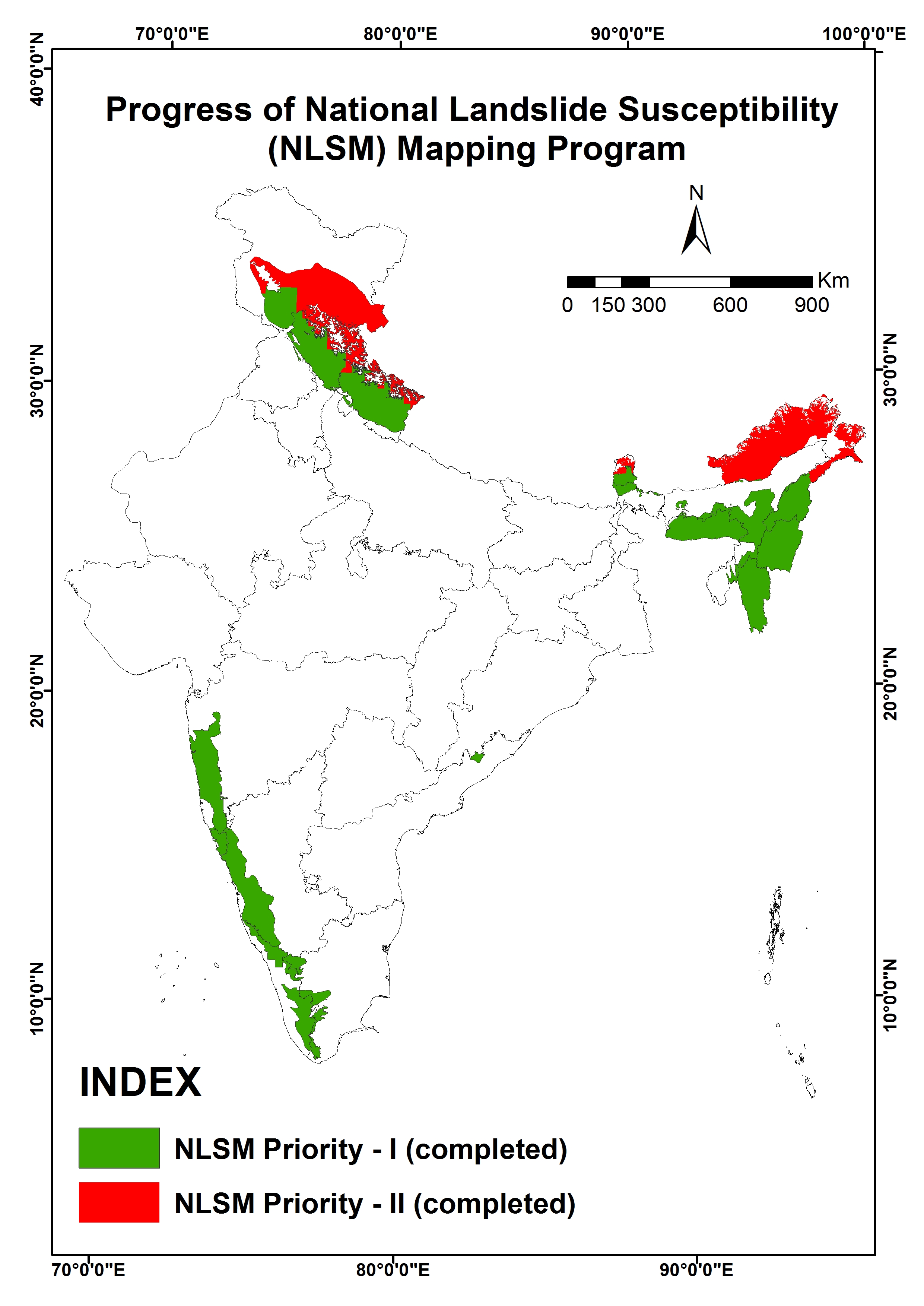
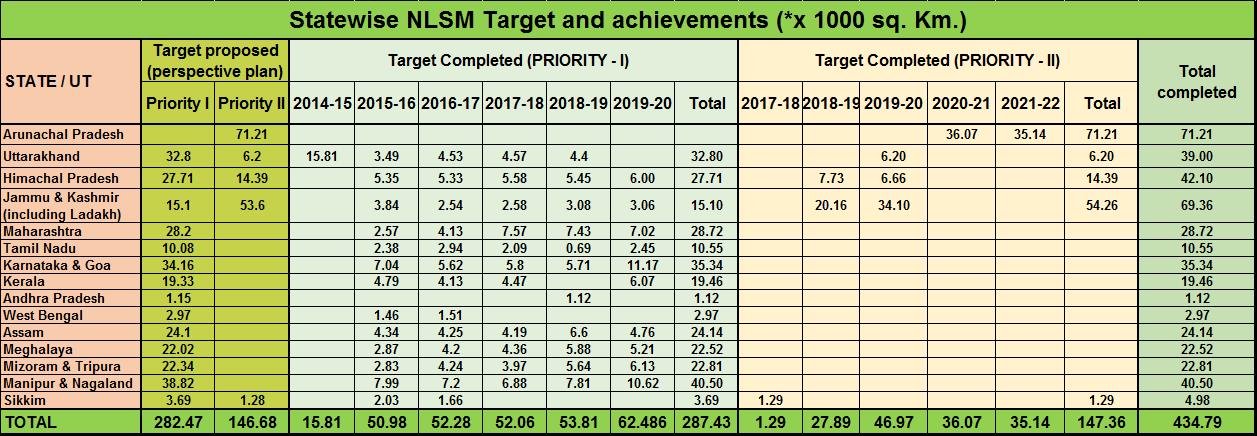
NLSM

This table structure facilitates the understanding and acquisition of crucial data required for NLSM studies, emphasizing the integration of multiple data sources for comprehensive analysis and assessment of seismic microzonation.

Data Type Data Sources
Slope Forming Material
  • 1:50K Geological map from GSI
  • 1:50K Geomorphological Map from NLGM Project
  • Google Earth data
  • 1:50K Land use/cover map to be consulted for preparation of pre-field map
Regolith Thickness
  • 1:50K Geological map from GSI
  • 1:50K Geomorphological Map from NLGM Project to be consulted for preparation of pre-field map
  • May be cross-checked once through visual examination with IRS P6 LISS-IV
Structure (Fault/Lineament)
  • 1:50K Geological map from GSI
  • 1:50K Geomorphological Map from NLGM Project to be consulted for preparation of pre-field map
  • May be cross-checked once through visual examination with IRS P6 LISS-IV
Structure (Regional Thrusts/Faults)
  • 1:50K Geological map from GSI
  • 1:50K Geomorphological Map from NLGM Project to be consulted for preparation of pre-field map
...
...